Pulteney Weir
What is it?
The 1603 map of Bath by Savile shows a weir on the River Avon to the
east of the Abbey. On the west (Abbey) bank is shown "The Monks Mill"
and on the opposite bank "Bathewick mill" [
Davis & Bonsall 2006].
The
photograph
below
is
taken
from
the
approximate
location
of
the
Monks
Mill.
The weir ran diagonally across the river to the Bathwick
Mill, which would have been where the leftmost tree now stands. The
purpose of the weir was to provide a difference in river level ( a
'head' of water) that would drive the water wheels used to power the
mills.
For centuries Bath had suffered from the River Avon flooding - even the
Romans had to raise the level of some of their baths complex to
alleviate the problem. Flood levels are marked on the buttress of
Widcombe footbridge, on buildings
in
Grove Street and on
Norfolk Buildings.
In the early 1970's the weir was rebuilt in its
current 'V' shape with an associated flood control gate (sluice) on the
east side of the river (see also
Civic
Trust
Award
page).
Pulteney Weir features in the recently released film of Les
Misérables. Part of the scene where Inspector Javert commits
suicide by jumping into the River Seine was filmed here in October 2012.
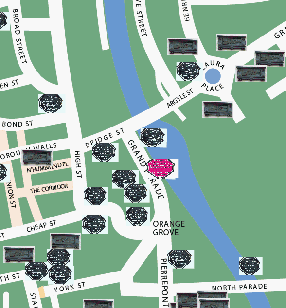
Where is it in Bath?
The weir is on the River Avon just downstream from
Pulteney Bridge:
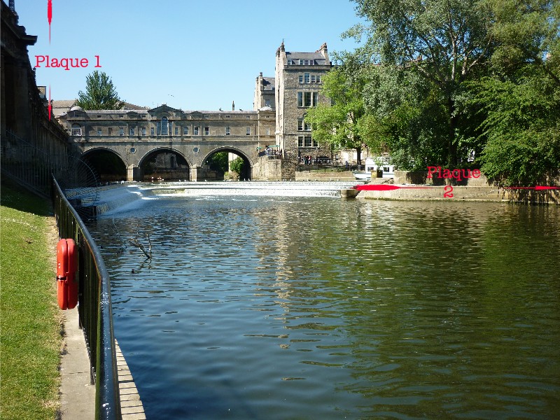 Plaque 1
 is
affixed to the balustrade on Grand Parade,
overlooking the weir:
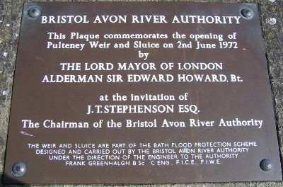
The text of Plaque 1 reads
"Bristol Avon River Authority
This Plaque commemorates the opening of Pulteney Weir and Sluice on
2nd June 1972
by The Lord Mayor of London Alderman Sir Edward Howard, Bt.
at the invitation of J.T.Stephenson Esq. The Chairman of the Bristol
River Authority
The weir and sluice are part of the Bath Flood Prevention Scheme
designed and carried out by the Bristol and Avon River Authority under
the direction of the engineer to the Authority Frank Greenhalgh B Sc.,
C Eng., F.I.C.E, F.I.W.E."
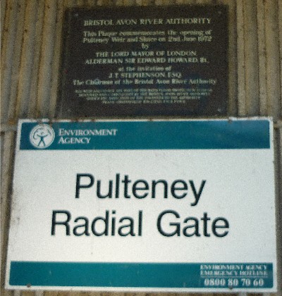
Plaque 2 is a duplicate
of plaque 1 and is fixed to the structure of
the flood control gate ("Radial Gate"):
Location map of plaque 1:
(c) 2013
Bath-Heritage.co.uk | Contact us|